Tuesday, June 21, 2011
??? miles
I got up just before 7 am and was out the door by 8:29 am.
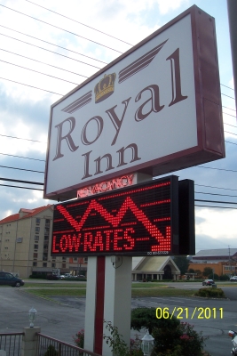 | 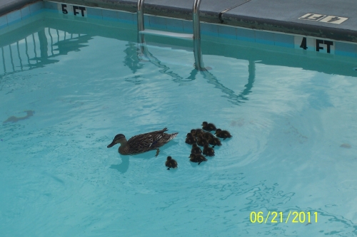 | |
| Sign for my hotel, the Royal Inn. Breakfast at the Royal Inn is Krispy Kreme donuts and coffee. | One of the cutest things I've seen in years: baby ducks with mom in the swimming pool! |
While the Royal Inn is on the older side, one of its great features is its location: it is at the intersection of highway 441
(main drag which goes from Knoxville to Gatlinburg) and highway 321 (the shortcut from Pigeon Forge to Townsend and Cades Cove).
I bought a sandwich at the Subway next door to the hotel, put it in my cooler with some drinks and chips,
and headed down highway 321 to Cades Cove. The twisty, turny drive takes 45-60 minutes. (I was at Cades Cove by 9:30 am.)
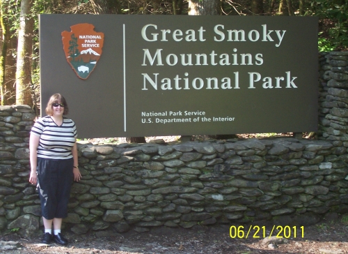 | 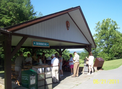 | |
| I had to get the classic national park sign picture, and I was lucky enough to arrive at the Townsend-end sign along with a faimily from New Orleans. They took my picture, and I took theirs! | As there is no entry fee for the park, the brochures cost $1 each. This is the orientation shelter at the beginning of the Cades Cove driving loop where I bought the great $1 Cades Cove brochure. | |
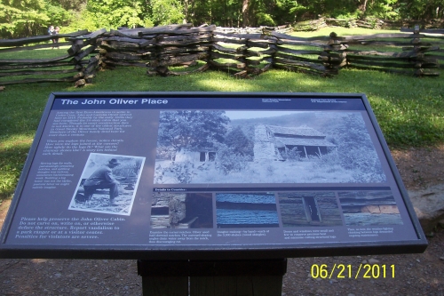 | 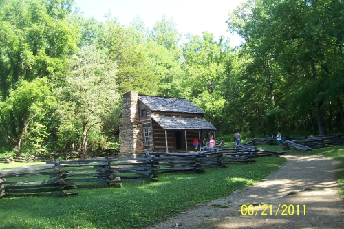 | |
| The first stop on the Cades Cove driving tour is the John Oliver place. The first set of parking spaces were full, so I parked in the second set and walked. All of the buildings can be entered, but they are empty. It is so sad to see how badly defaced with graffitiall these historic buildings are, though--the worst I've seen anywhere. | ||
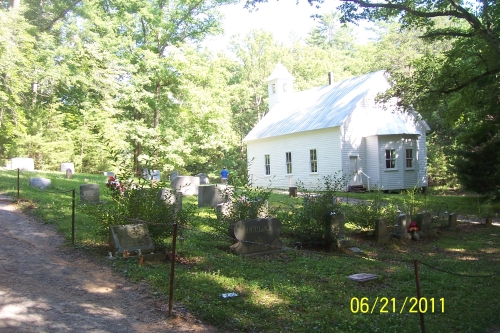 |  | |
| There are three historic churches on the Cades Cove tour loop. This is the Missionary Baptist Church. | The weather was beautiful that day, and the mountain views were amazing! | |
 | 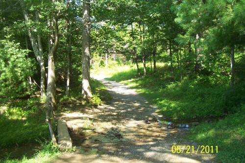 | |
| I decided to park and walk to the Elijah Oliver place. This sign said it would only be 0.4 miles. | One of the first things on the trail was to walk across this basic bridge. It was amazing to go from near-gridlock on the road to complete solitude on the trail. | |
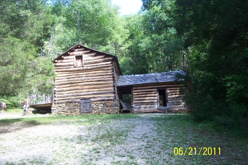 | 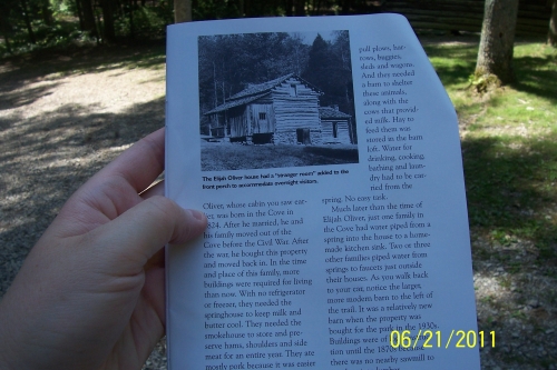 | |
| Here
is the Elijah Oliver place. Compare the place as it appeared in
June 2011 to the historic photo in the Cades Cove tour brochure. On the whole trail, I only saw people once: the family in the photo. They had just seen a bear! (I was glad I missed it.) | ||
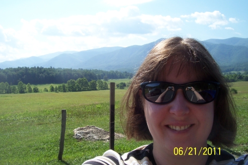
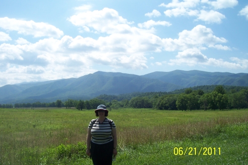 | The weather was so nice! I really enjoyed the mountain views. | |
| I reached the half-way point of the Cades Cove loop--the Mill Area--at 11:15 am. There are restrooms and a large parking area. I sat in my car (as there is no picnic area!) and ate my lunch. What a gorgeous view! I stayed in the mill area for about 45 minutes. | 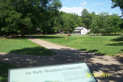 | |
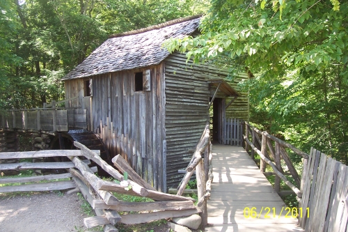 | 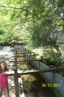 | |
| The mill area has a house, two barns, a smokehouse, a sorghum furnace, and blacksmith shop. This is the mill, which the park has working, with its working waterwheel. | Most impressive was the longest mill race I've ever seen! | |
After finishing the Cades Cove driving loop, I took the twisty, turny, scenic Laurel Creek Road through the park to get to the Laurel Falls trailhead.
Unfortunately, everyone else in the park seemed to also want to walk the trail, so there was no parking available.
I drove a few minutes down the road to Maloney Point (which has a nice parking area--and it was empty!), parked the car,
ate the rest of my sandwich, and walked ten minutes down the road to the Laurel Falls trailhead.
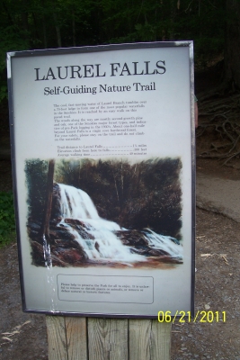 | 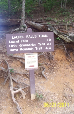 | |
| The Laurel Falls trail is 1.3 miles each way. It takes 40-45 minutes in (as it is paved but mostly uphill) and less than that (35-40 minutes) back. | ||
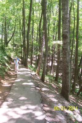 | The Laurel Falls trail reminded me so much of the Whirlpool trail in the Niagara Gorge in Ontario. At one point, the view was so similar, I had a hard time reminding myself I was in Tennessee! | |
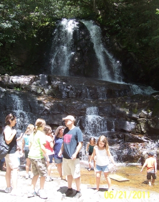 | 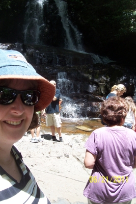 | |
| I
wish I had brought a towel! It was hot and sunny, and I would
have enjoyed putting my feel in the waterfall. It looked so fun! (The thought of walking back in squishy shoes made me think again, though.) | ||
It was nearly 3:00 pm and raining, so I drove to the Sugarlands Visitor Center.
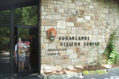
Outside the visitor center, there are two nice nature trails: the Cove Mountain Trail (that leads to Cataract Falls)
and the Fighting Creek Self-Guided Nature Trail (that leads to the John Ownby cabin).
NOTE that both of these trails seem to take much longer than the maps and distances would indicate.
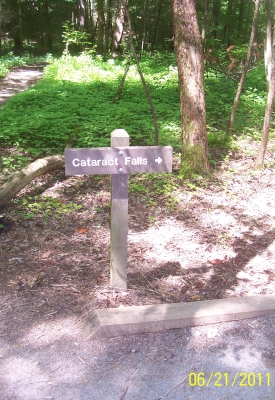 | My next trail was to Cataract Falls. | |
| The trail to Cataract Falls was wooded and along streams. It was beautiful, a combination of Riverside Park in Ypsilanti, Michigan, and behind the visitor center at Point Pelee National Park in Leamington, Ontario. | 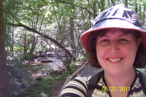 | |
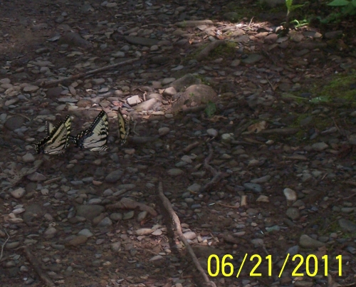 | There were so many butterflies, both yellow (like these) and blue! | |
| I made it to Cataract Falls, again without a towel. | 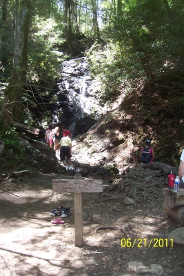 | |
 | Waterfall walks are so fun! | |
| After
Cataract Falls, I doubled back and took the Fighting Creek Self-Guided
Nature Trail that leads to this, the John Ownby cabin. It was shocking to me that I didn't see a single other person on this trail, only steps from the visitor center. It was very peaceful. | 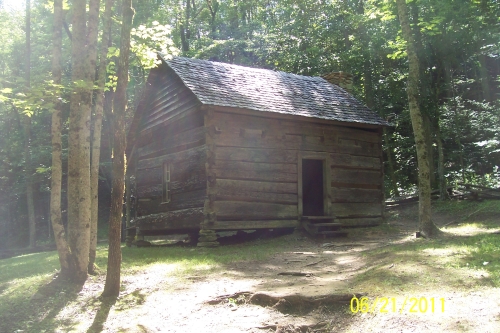 |
It had already been a great day, but I wanted to do one more waterfall walk.
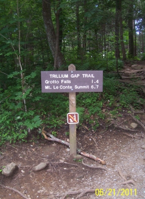
I decided to do the Trillium Gap trail to Grotto Falls.
The trailhead is half-way along the narrow, twisting Roaring Fork Motor Nature Trail.
 | I started the Trillium Gap trail to Grotto Falls at 5:00 pm. To Grotto Falls and back takes about 1.5 hours. | |
| The Grotto Falls trail is more challenging than the others I walked in Great Smoky Mountains National Park. There are a lot of tree roots and rocks. | 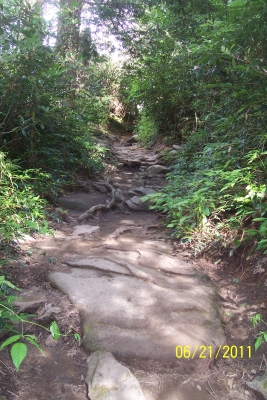 | |
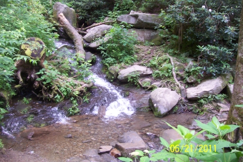 | Along the way, there are four small waterfalls whose streams cross the trail. I don't have very good balance, but I was able to pick my way across the wet, slippery rocks and only step in the water once! | |
| Grotto Falls is there in the background. Almost there! | 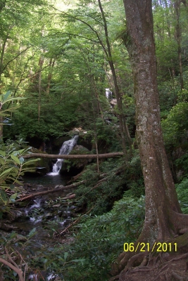 | |
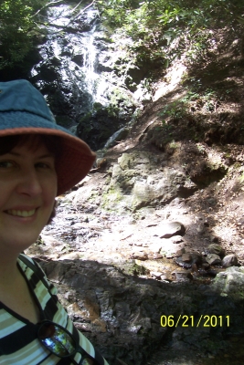
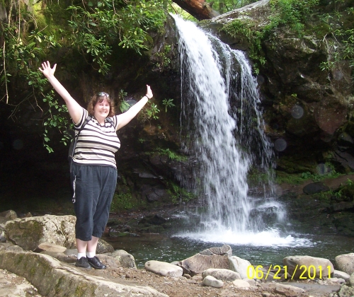
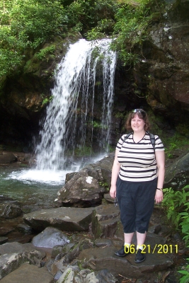 | Here I am at Grotto Falls. There were two other people there when I was. Another hiker took this picture of me with the waterfall. | |
| The nifty thing about Grotto Falls is that you can walk behind it. Here I am behind the falls! It reminded me so much of the waterfall I visited in Bafilo, Togo! | 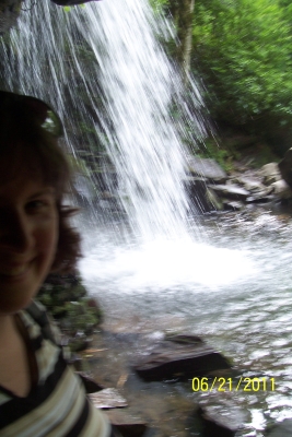 | |
 | I had such a great day in the Smokies!! |
That night, we had a strong thunderstorm. The power at the hotel even went out briefly.
I was so beat from all my hiking, I couldn't even finish my dinner.
| Back to Itinerary | On to Day 4 |